![]()
![]()
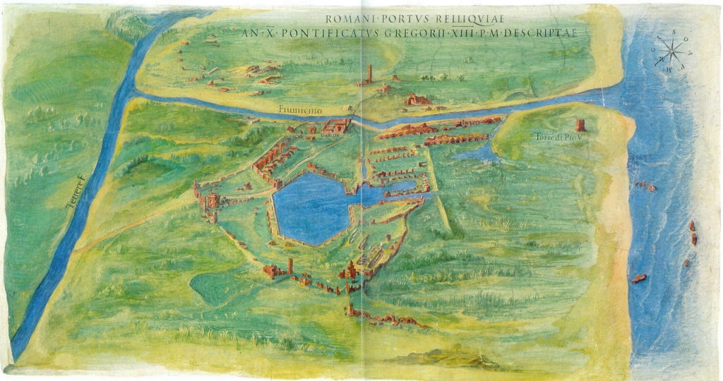
Danti's fresco and the new data on the extension of the harbour of Claudius
In the Vatican Gallery of Maps is a fresco of the Portus area, painted in 1582 by Antonio Danti after cartoons of Ignazio Danti. The fresco shows the situation of the coastal area towards the end of the sixteenth century, as seen from the north in an oblique view.
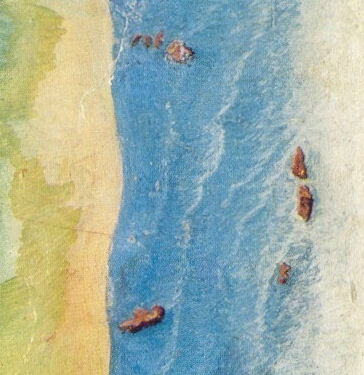
From Testaguzza 1970.Several details can be recognized, which testify to the reliability of the map. In the upper left the Tiber meander can be seen that was cut off during the flood of 1557 ("Fiume Morto"). Most interesting is the presence on the fresco of several structures in the sea near the coastline. These were also described by several eye witnesses in the fifteenth century. We know that this was the period in which the coastline advanced very quickly, on average about nine meters per year.
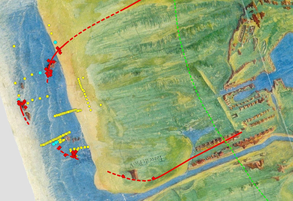
Detail of the structures in the sea.The image below is the work of Antonia Arnoldus-Huyzendveld. Part of the fresco has been digitally stretched and flattened. She then overlaid on it the data from her drillings and the interpretation of the extension of the harbour of Claudius (published in 2011). It is surprising to see how well the structures visible in the sea at the end of the sixteenth century correspond to what has been found in the drillings.
Legend:
- In red squares the drillings with Roman structures under a cover of several meters of dune sand.
- In red lines the two moles and the lighthouse-island, certain (full) or uncertain (hatched).
- In yellow the drillings with a normal marine sedimentation sequence.
- In blue the drillings with signs of high velocity streams; note that these always occur near structures.
- A green hatched line indicates the probable coastline before the construction of the harbour.
![]()
![]()