|
| The building |
| Description and function |
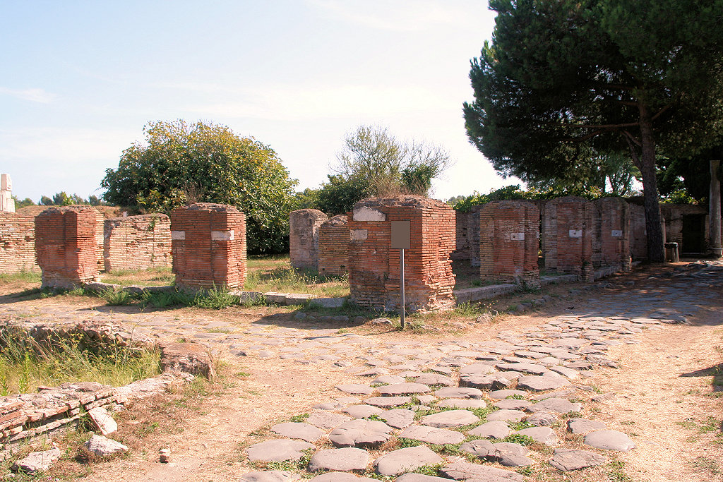
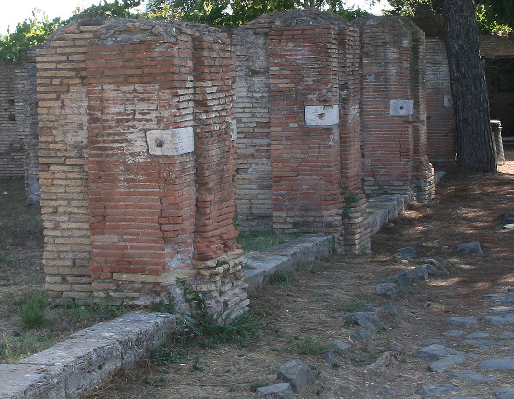
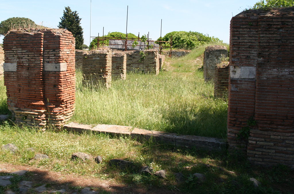
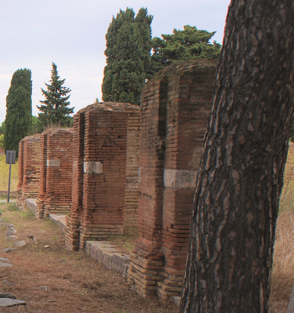
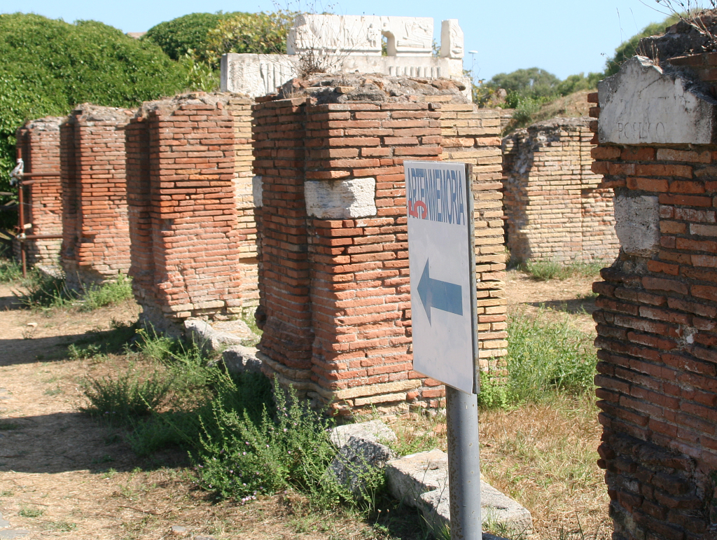
The function of this structure is unknown. It is located on the intersection of the western Decumanus Maximus and the Via di Cartilio Poplicola. The remains are mainly made up of brick piers, each with a decorative pilaster. To the south-west are staircases, to the south is a small courtyard. |
| Date |
The structure was built during the reign of Hadrian, with red and yellow bricks. |
|
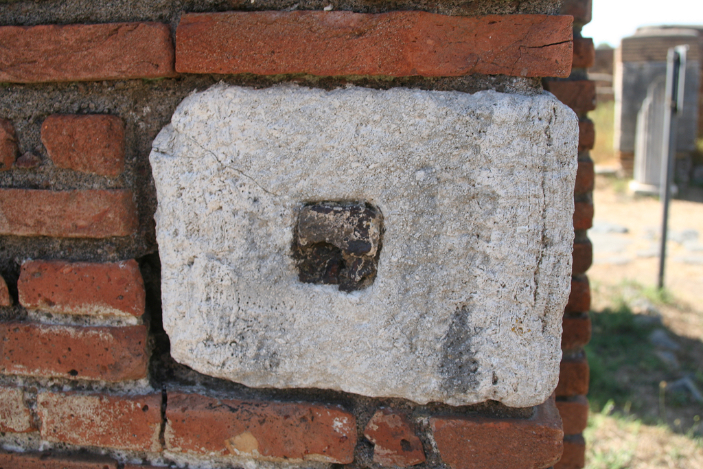
Nrs. 650-659
|
| Description |
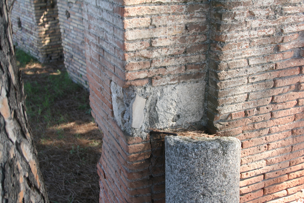
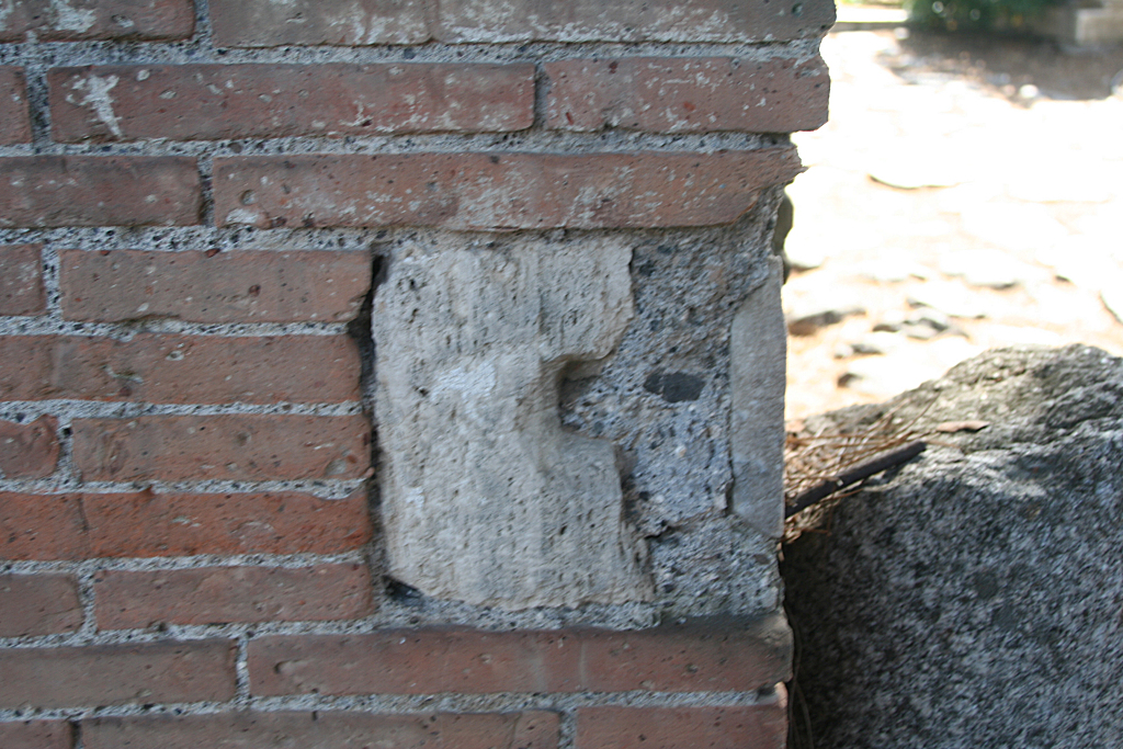
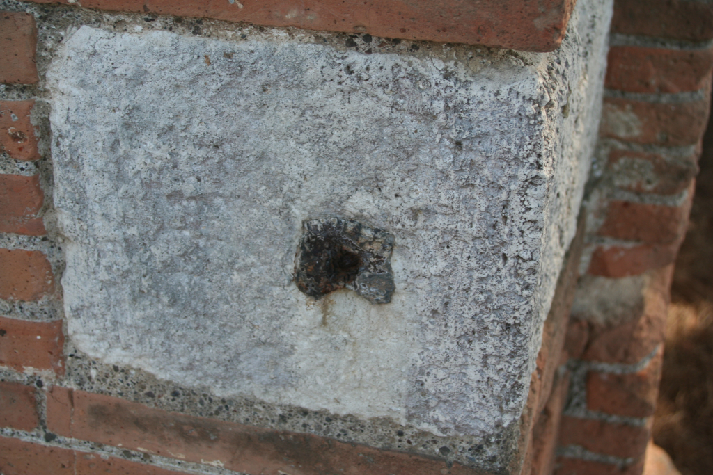
Ten cornerstones can be seen, all at mid height.
|
| Date |
The stones are in the masonry of the first building phase. On the inside of most stones is a hole. Two holes are facing the street. A few of the holes still preserve metal. Number 650 has a half-broken hole facing the street, 651 has no hole, 652 has a hole with metal, 653 is damaged, 654 has a hole, 655 has a hole with metal facing the street, 656 has a hole with metal, 657 has a hole, 658 is damaged but seems to have had a hole, 659 has a hole with metal. |
| Measurements |
Meas. VdM, 650, starts at 1.15; l. 0.37, w. 0.20, h. 0.19; 651, starts at 1.15; l. 0.37, w. 0.22, h. 0.19; 652, starts at 1.15; l. 0.35, w. 0.24, h. 0.19; 653, starts at 1.25; l. 0.34, w. 0.21, h. 0.18; 654, starts at 1.25; l. ?, w. ?, h. 0.18; 655, starts at 1.25; l. 0.35, w. 0.24, h. 0.16; 656, starts at 1.25; l. 0.37, w. 0.19, h. 0.16; 657, starts at 1.15; l. ?, w. ?, h. 0.17; 658, starts at 1.15; l. ?, w. ?, h. 0.17; 659, starts at 1.15; l. 0.37, w. 0. 22, h. 0.16. |
|
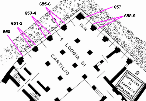
Plan of the building. After SO I.
|