![]()
![]()
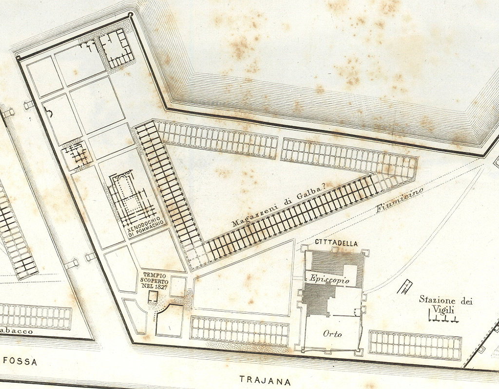
In this area, directly behind side IV of the hexagon, horrea with a triangular shape can be seen on the plan that was published by Rodolfo Lanciani in 1868 [37-38]. One side is running parallel to side IV, another to the channel leading from the Fossa Traiana to the harbour basins, and the third to a modern road. Lanciani informs us that they were excavated in 1867. He suggests that they were used for storing olive oil and named after Galba: an inscription found in Ostia mentions a procurator ad oleum in Galbae Ostiae Portus Utriusque. However, the reference could well be to the Horrea Galbae in Rome.
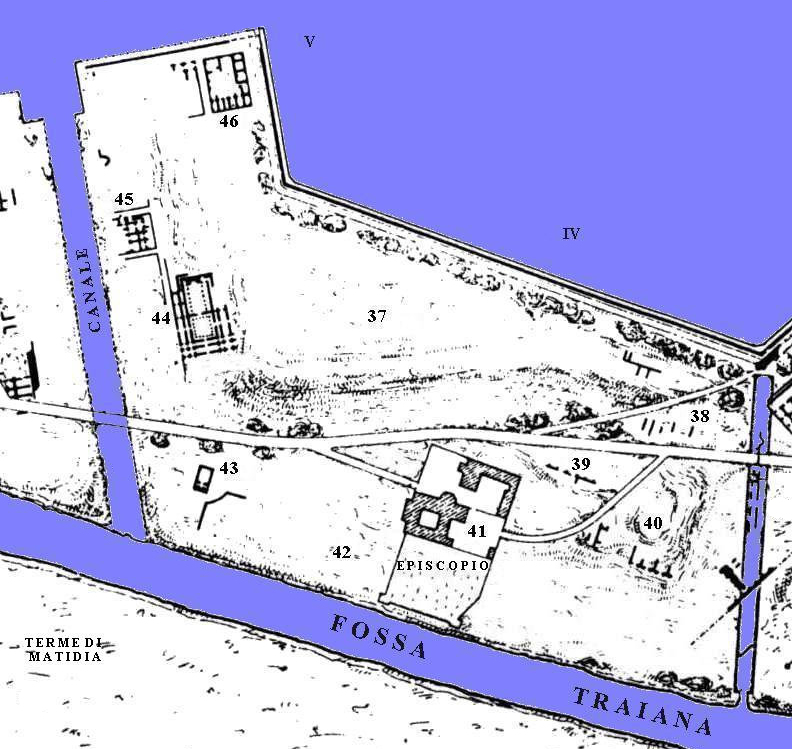
Rodolfo Lanciani's plan of the area (1868).At the time when Giuseppe Lugli studied Portus, the ruins were mostly buried, and they are not depicted on the accompanying pIan from 1935. However, Lugli does note opus mixtum from the Trajanic period. A bit to the south are some brick walls of a building that Lugli dates to the second half of the second century AD [39].
Italo Gismondi's plan of the area (1933).Between the channel and side V of the hexagon are buildings 45 and 46. In the buried remains of the former building Lugli recognizes Trajanic horrea (opus mixtum). At present nothing can be said about building 46.
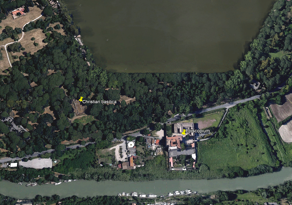
Aerial view of the area. Photo: Google Earth.Sources
Lanciani 1868, 180-181; Calza 1925, 68.
![]()
![]()