![]()
![]()
In Tegna, to the north-west of Locarno, archaeological remains have been found on a plateau to the north. The plateau, measuring 400 x 160 m., is known as Castello di Tegna and was used already in the neolithic period. Excavations were carried out in the years 1941-1945.
Map of the plateau. Gerster 1969, Abb. 26.
A, B: rocky outcrops; G: prehistoric tomb; H: central building; M: Medieval fortification; P: prehistoric house.
I-IV: late-antique wall at different levels; 1-5: late-antique towers and buildings.
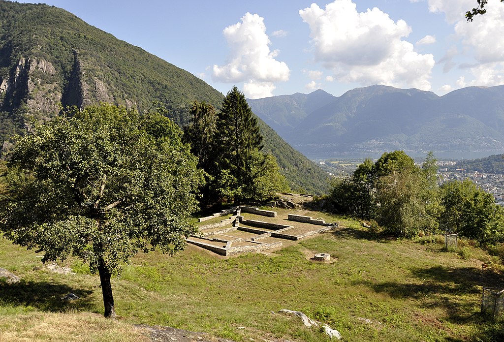
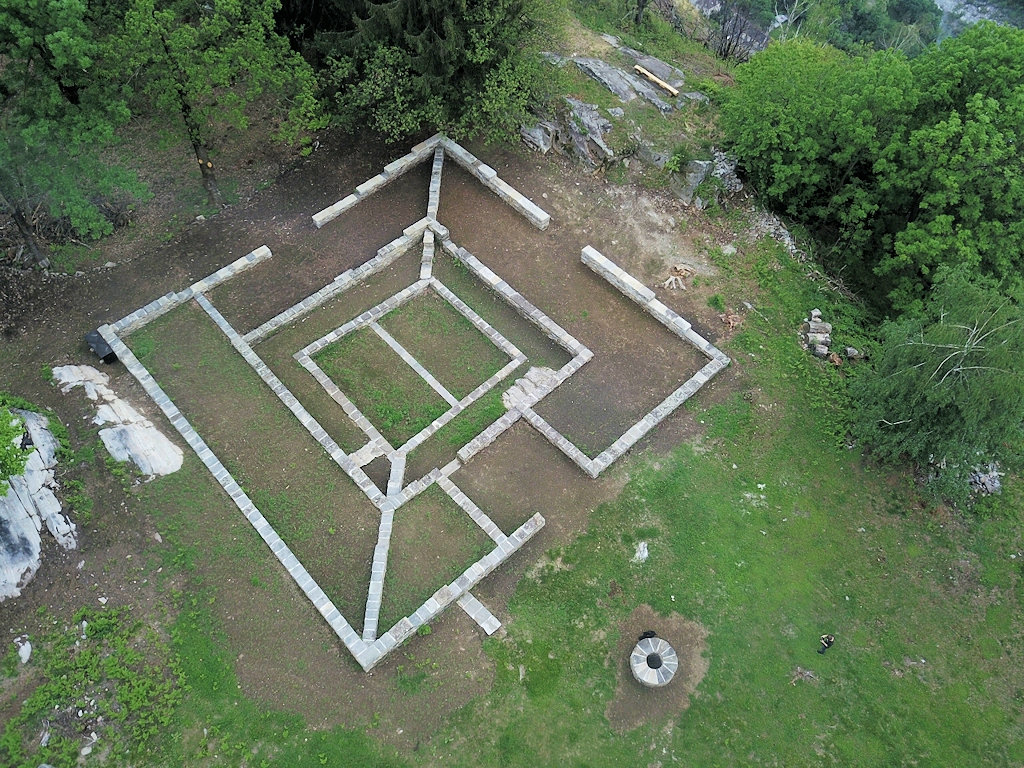
General view of the plateau, seen from the north-west. Photo: Wikimedia, Angela Martignoni.
View of the plateau from the north-west, from building M. Photo: museocentovallipedemonte.ch.On the circumference of the plateau were walls at different levels, 2.50-4.00 m. wide, with at least three rectangular towers. In one of the towers a coin was found of Constans I, from the period 330-350 AD. It has been suggested that this fortification was built in the late fourth or fifth century, completing an earlier, unfinished fortification.
Reconstruction drawings of the towers. Gerster 1969, Abb. 34-36.
On the western part of the plateau a large and rather enigmatic building was found. The building consists of three inscribed squares with sides measuring 22.50, 13 and 9 m. They were connected by a curious diagonal wall. The building had entrances on three sides, 1.80-2.40 m. wide.
Plan and cross-sections of the central building. Gerster 1969, Abb. 6.
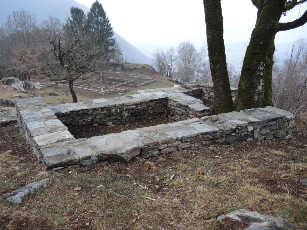
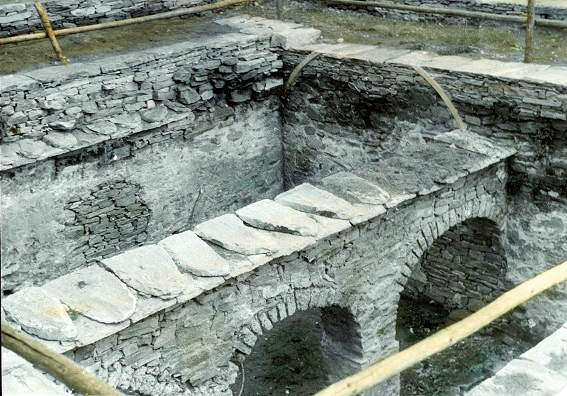
General view of the central building. Photo: vici.org.The innermost square (on the inside 7.50 x 7.50 m.) seems to have been a cistern. It could only be accessed through an opening in the vaulted ceiling using a ladder. The walls were covered with waterproof plaster (opus signinum). It was divided in two by a wall with three arches. Each half was covered by a barrel vault, reaching a height of four meters. At the level of the ground floor the cistern may have been surrounded by columns or piers, creating a porticus that was 1.80 m. wide. Many roof tiles were found. The building probably had an inward-sloping roof to collect rainwater. Next to the building, seven meters away, a well was found. Water from overflow openings in the cistern was led to this well.
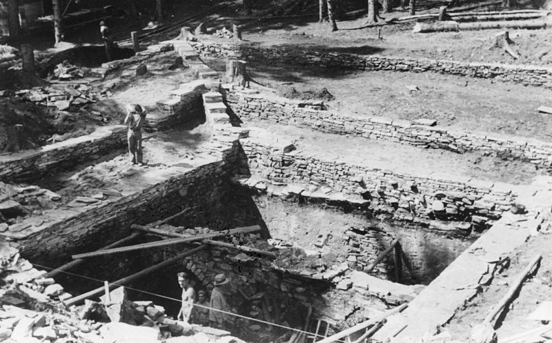
The excavation of the central square. Photos: museocentovallipedemonte.ch.
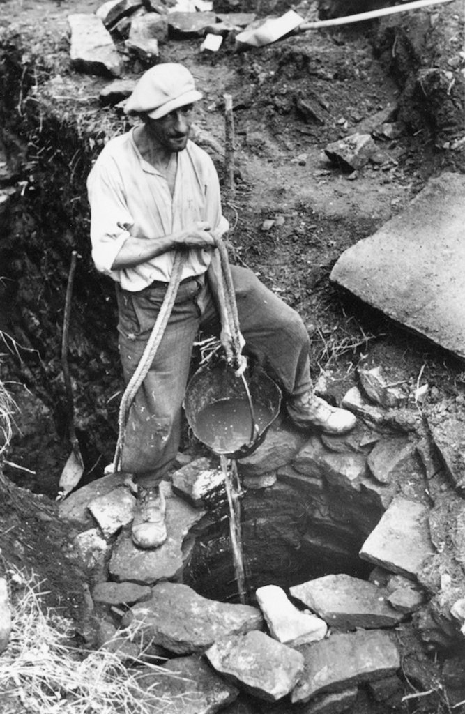
The excavation of the well. Photo: museocentovallipedemonte.ch.It has been suggested that the central building was a temple, but this is disputed (cisterns below temples are documented elsewhere, for example in Henchir-Debbik in Tunisia). The dating is also unclear.
Reconstruction drawing of the central building. Gerster 1969, Abb. 10.


Literature
R. Cagnat, Les monuments historiques de la Tunisie. Les monuments antiques. Les temples païens, Paris 1898, 117-118 (for the temple in Henchir-Debbik); Gerster 1969; Drack-Fellmann 1988, 525; Drack-Fellmann 1991, 261-262; Gillioz 2016; Gillioz 2017.
Recent research is presented on the website Il Castelliere.
[21-Jan-2024]