![]()
![]()
To the east of the Museum of the Ships was a north-south running quay. It had a facing of tufa stones, covered with terracotta tiles. Geological research has indicated that there was a lagoon to the east, so that the quay is on a narrow "peninsula" (or even a few little islands) between the basin of Claudius and the lagoon. It will have been connected to the mainland near the so-called Horrea-baths (see Harbour of Trajan, nr. 15).
On the north part of the "peninsula" a building was excavated in the 1960's. It was erected in the second century AD. Restorations and paintings have been dated to the early fourth century (opus vittatum). In a heated room, with heating pipes set against the walls, part of a painted ceiling was found, with depictions of eagles, horsemen, masks (perhaps of winds) and perhaps a lighthouse. This has led to the suggestion that the building was the harbour master's office. It was therefore called Capitaneria di Porto (Office of the port authority). There is also a small slipway for boats, reached from the east.
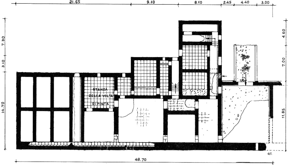
Plan of the Capitaneria. Testaguzza 1970, 99.
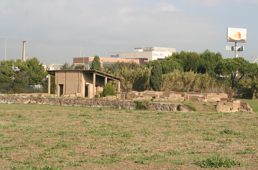
The ruins of the Capitaneria. Photo: Jan Theo Bakker.
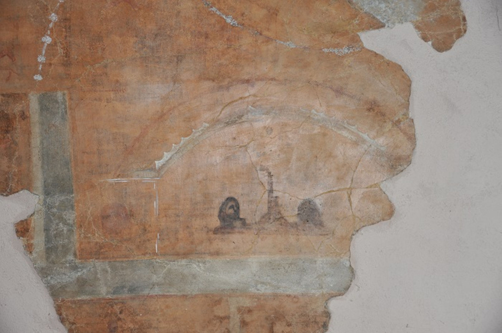
Click on the image to enlarge. Painting from the Capitaneria.
Two masks of winds flank a high tower, a lighthouse?
Photo: Parco Archeologico di Ostia Antica.
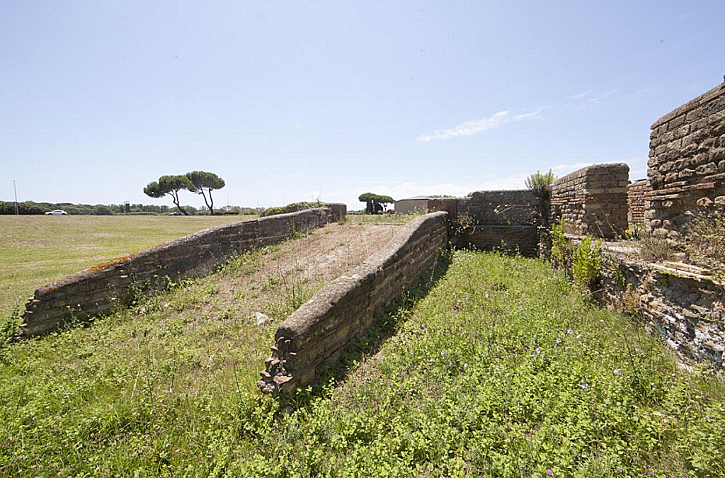
The small slipway. Photo: Arnoldus-Huyzendveld et al. 2015, fig. 1.
![]()
![]()